 赞
赞
的个人主页 http://grzy.cug.edu.cn/lishaobo/zh_CN/index.htm
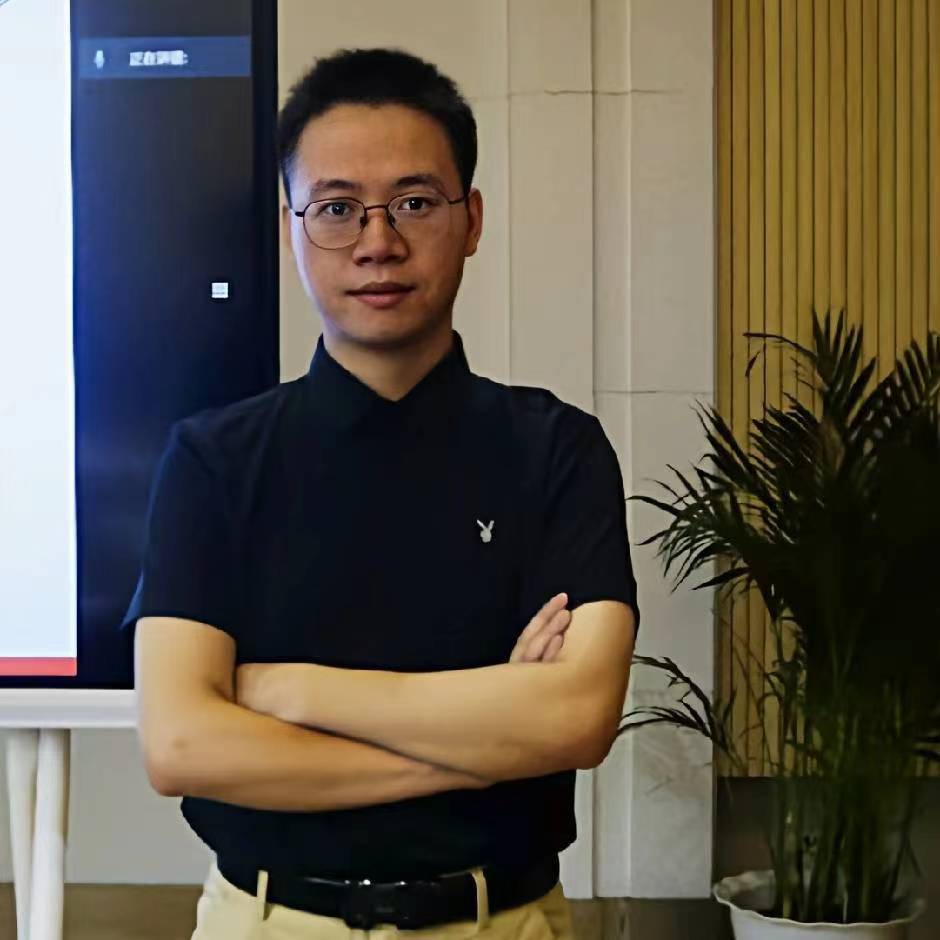
李邵波,工学博士,2022年6月毕业于武汉大学测绘学院。2022年9月以“地大学者”青年优秀人才引进至中国地质大学(武汉)地理与信息工程学院测绘遥感系工作,2024年9月至2025年9月以访问学者身份在新加坡国立大学建筑与环境系交流。现担任武汉大学学报信息科学版青年编委,以第一作者及通讯作者在TOP期刊IEEE Transactions on Geoscience and Remote Sensing、海洋工程领域著名期刊 Ocean Engieering, IEEE Journal of Oceanic Engineering等国内外期刊发表学术论文23篇;主持国家自然科学基金、省自然科学基金、博士后特别资助基金项目等5项,参与海洋"127"专项、国家自然科学基金面上项目等5项;担任IEEE Journal of Oceanic Engineering, Journal of Selected Topics in Applied Earth Observations and Remote Sensing,IEEE Transactions on Geoscience and Remote Sensing等期刊审稿人。
学术主页:https://www.researchgate.net/profile/Li-Shaobo-3
研究兴趣:水下地形地貌底质数据处理、海洋声学遥感及解译、水下目标智能探测、水下导航定位等
所在团队:大地测量与导航团队(学院重点打造的4支引领性团队),团队成员:吴云龙(团队负责人),丁开华,张绍成,史绪国,钟玉龙、张毅
热烈欢迎有 大地测量 /测绘工程 /摄影测量与遥感 /海洋工程 等背景的同学报考、交流!
学术论文(Last Updated on 2025.05)
一作/通讯论文如下:
[23] Gao Haolong (硕士生); Li, Shaobo*; Zhouyi Kang; Fan Zhang; Yi Zhang; Wu, Yunlong. Removal of LiDAR Negative Outliers based on Retroreflective Surface [J]. IEEE Journal of Selected Topics in Applied Earth Observations and Remote Sensing. 2025, 18, 16831. (中科院SCI二区, 通讯作者)
[22] Shaobo Li, Tie Li*, Yunlong Wu. Side-scan sonar mine-like target detection considering acoustic illumination and shadow characteristics [J]. Ocean Engineering. 2025, 336. (T1, 第一作者).
[21] 高浩龙(硕士生), 李邵波*, 赵建虎, 镜像结构和强度特征约束的海岸带LiDAR点云多路径负异常点去除方法[J]. 测绘学报, 2025, 54(5): 840-852. (T2, 通讯作者).
[20] Li, Shaobo; Li Tie; Sun, Aiguo; Shiqi Wang; Wu, Yunlong. Automated Amplitude and Phase Attribute-based Horizon Picking Applied to 3D Sub-Bottom Data[J]. IEEE Journal of Oceanic Engineering. 2025, 50(3),2355-2368. (中科院SCI二区, 第一作者,IF= 3.554)
[19] 李邵波, 赵建虎, 王爱学, 丁咚, 吴云龙. 结构特征约束的三维浅剖声呐层界提取[J]. 测绘学报, 2025, 54(2): 262-271. (T2, 第一作者)
[18] Li, Shaobo; Shang, Xiaodong; Wang, Shiqi; Wu, Yunlong; Zhao, Jianhu. A Geometric and Radiometric-Invariant Matching Method for SSS and MBES Data [J]. IEEE Transactions on Geoscience and Remote Sensing. 2024, 62, 1-13. (中科院SCI一区,第一作者,IF=5.6)
[17] Li, Shaobo; Zhao, Jianhu; Wu, Yunlong*; Bian, Shaofeng; Zhai, Guojun. SSS Radiometric Distortion Correction Based on Variational Retinex Framework with Consideration for Sediment Characteristics [J]. IEEE Transactions on Geoscience and Remote Sensing. 2023, 61, 1-11. (中科院SCI一区,第一作者,IF=5.6)
[16] Li, Shaobo; Zhang Yi*; Zhao, Jianhu; Wu, Yunlong; Bian, Shaofeng; Zhai, Guojun. A Comprehensive buried shipwreck detection method based on 3D SBP data [J]. IEEE Journal of Oceanic Engineering. 2024, 49(2), 458-473. (中科院SCI二区, 第一作者,IF= 3.554)
[15] Zong, Zaixiang; Zhao, Jianhu; Li, Shaobo*; Zhang, Hong. Automatic Marine Sub-Bottom Sediment Classification Using Feature Clustering and Quality Factor [J]. Journal of Marine Science and Engineering. 2023, 11, 1770. (中科院SCI三区, 通讯作者,IF= 2.9)
[14] Li, Shaobo*; Zhao, Jianhu; Wu, Yunlong; Bian, Shaofeng; Zhai, Guojun. Marine Sediment Classification Spectral Ratio Technique from a Signal Decomposition View Based on Chirp Sonar Data [J]. IEEE Transactions on Geoscience and Remote Sensing. 2023, 61, 1-12. (中科院SCI一区,第一作者,IF=5.6)
[13] Li, Shaobo; Ma, Jinfeng*; Wu, Yunlong; Xiang Zhou; Bian, Shaofeng; Zhai, Guojun. SSS Small Target Detection via Combining
Weighted Sparse Model With
Shadow Characteristics [J]. IEEE Transactions on Geoscience and Remote Sensing. 2023, 61, 1-14. (中科院SCI一区,第一作者,IF=5.6)
[12] Li, Shaobo; Zhao, Jianhu*; Wu, Yunlong; Bian, Shaofeng; Zhai, Guojun. Prior Frequency Information Assisted VMD
Method for SBP Sonar Data Noise Removal [J]. IEEE Geoscience and Remote Sensing Letters. 2023, 20, 1-5. (中科院SCI二区,第一作者,IF=3.966)
[11] Li, Shaobo*; Zhao, Jianhu; Yu Yongcan; Wu, Yunlong; Bian, Shaofeng; Zhai, Guojun. Anisotropic Total Variation Regularized Low-Rank Approximation for SSS Images Radiometric Distortion Correction [J]. IEEE Transactions on Geoscience and Remote Sensing. 2022, 60, 1-12. (中科院SCI一区,第一作者,IF=5.6)
[10] Li, Shaobo; Zhao, Jianhu*; Zhang, Hongmei; Zhang, Youpeng. Automatic Detection of Pipelines in Sub-bottom Profiler Sonar Images[J]. IEEE Journal of Oceanic Engineering. 2022, 47(2), 417-432.(中科院SCI二区, 第一作者,IF= 3.554)
[9] Li, Shaobo; Zhao, Jianhu*; Zhang, Hongmei; Gong, Quanhua; Bi, Zijun; Qu, Siheng. Surface Extraction and Segmentation from 3D Underwater Sub-bottom Point Clouds Using Enhancement Filtering and Global Energy Optimization[J]. IEEE Transactions on Geoscience and Remote Sensing. 2022, 60, 1-14. (中科院SCI一区,第一作者,IF=5.6)
[8] Li, Shaobo; Zhao, Jianhu*; Zhang, Hongmei; Qu, Siheng. Sub-bottom Profiler Sonar Image Missing Area Reconstruction Using Multi-survey-line Patch Group Deep Learning[J]. IEEE Geoscience and Remote Sensing Letters. 2022, 19, 1-5. (中科院SCI二区,第一作者,IF=3.966)
[7] Li, Shaobo; Zhao, Jianhu*; Zhang, Hongmei; Qu, Siheng. Sub-bottom Sediment Classification Using Reliable Instantaneous Frequency Calculation and Relaxation Time Estimation[J]. Remote Sensing. 2021, 13, 4809. (中科院SCI二区,第一作者,IF= 4.848)
[6] Li, Shaobo; Zhao, Jianhu*; Zhang, Hongmei; Qu Siheng. An Integrated Horizon Picking Method for Obtaining the Main and Detailed Reflectors on Sub-Bottom Profiler Sonar Image[J]. Remote Sensing. 2021, 13, 2959. (中科院SCI二区,第一作者,IF=4.848)
[5] Li, Shaobo; Zhao, Jianhu*; Zhang, Hongmei; Bi, Zijun; Qu Siheng. A Novel Horizon Picking Method on Sub-Bottom Profiler Sonar Images[J]. Remote Sensing. 2020, 12, 3322. (中科院SCI二区,第一作者,IF=4.848)
[4] Li, Shaobo; Zhao, Jianhu*; Zhang, Hongmei; Bi, Zijun; Qu Siheng. A Non-Local Low-Rank Algorithm for Sub-Bottom Profile Sonar Image Denoising[J]. Remote Sensing. 2020, 12, 2336. (中科院SCI二区,第一作者,IF=4.848)
[3] Zhao, Jianhu; Li, Shaobo*; Zhao, Xi; Feng, Jie. A Comprehensive Horizon Picking Method on Sub-bottom Profiles by Combining Envelope, Phase Attributes, and Texture analysis[J]. Earth and Space Science. 2020, 7(3): 1-20. (中科院SCI三区,通讯/导师一作,IF=2.9)
[2] Zhao, Jianhu; Li, Shaobo*; Zhang, Hongmei; Feng, Jie. Comprehensive Sediment Horizon Picking From Sub-bottom Profile Data[J]. IEEE Journal of Oceanic Engineering. 2019, 44(2): 524-534. (中科院SCI二区,通讯/导师一作,IF= 3.554)
[1] 李邵波; 周丰年*; 赵建虎; 冯杰. 联合灰度突变和方向约束的浅剖层位自动拾取[J]. 武汉大学学报信息科学版. 2019, 44(4): 532-538. (EI,第一作者,IF=1.284)
科研项目
主要主持的项目如下:
[7] 顾及几何形态特征的三维浅剖海底掩埋目标精准探测,国家自然科学基金青年项目,项目批准号:42304049,2024.01至2026.12,主持;
[6] 层界信息约束的海底掩埋沉船三维形态估计,自然资源部海底环境探测技术与应用重点实验室开放基金,课题编号:MESTA-2022-B007,2023.04至2025.4,主持;
[5] 联合目标阴影伴随特征和深度学习去噪的侧扫声纳小目标精准探测,中国博士后科学基金第74批面上资助,资助编号:2023M743282,2024.01至2026.01,主持;
[4] 频域特征约束的辐射畸变下侧扫声纳小目标精准探测,中国博士后科学基金第17批特别资助,资助编号:2024T170856,2024.08至2026.08,主持;
[3] 顾及目标阴影和辐射畸变的侧扫声纳小目标精准探测,自然资源部海底科学重点实验室开放基金,资助编号:KLSG2406,2025.01至2026.12,主持;
[2] 湖北省自然科学基金青年基金,资助编号:2023AFB017,2023.07至2025.06,主持;
[1] 中国地质大学(武汉)科研启动金,资助编号:2022152,2022.09至2025.09,主持;
主要参与的项目如下:
[5] 基于侧扫声呐测量信息的海底地貌图像、地形和底质一体化获取,国家自然科学基金,面上项目,2022.01至2025.12,参与
[4] 深水声学回波强度与海底矿产资源响应机制的建立,广州海洋地质调查局合作项目,国家专项,2020.5至2020.11,参与
[3] 深水多波束回波强度数据特殊处理,广州海洋地质调查局合作项目,国家专项,2019.04至2019.12,参与
[2] 天然气水合物海底浅表层声学探测数据处理方法及应用,广州海洋地质调查局合作项目,国家专项(127工程),2018.01至2018.12,参与
[1] 天然气水合物海底浅表层声学探测数据处理技术研究,广州海洋地质调查局合作项目,国家专项(127工程),2016.05至2017.06,参与
学生培养
[5] 硕士研究生高浩龙获2025年国家奖学金、2024年院级科技论文报告会一等奖、2024年校级科技论文报告会一等奖;
[4] 2025省级大学生创新训练计划一般项目,基于深度学习的侧扫声呐少样本小目标探测,负责人23级本科生熊奕明;
[3] 2024院级大学生创新创业训练计划(产学研),基于YOLOv8网络的声学图像小目标探测,负责人23级本科生熊奕明;
[2] 2024省级大学生创新创业计划一般项目,海底掩埋管线的浅剖声呐实时智能探测,负责人22级本科生李振超;
[1] 2023院级大学生创新创业训练计划(产学研),基于三维声纳点云的水下构筑物智能提取方法研究,负责人21级本科生刘宇晗。.
科研获奖
[1] 全水深海洋空间地理信息高精度高分辨率获取理论、方法与应用,测绘科技进步奖,省部级一等奖,测绘地理信息学会,2018年
其他获奖
[7] 武汉大学学术创新奖学金、武汉大学优秀毕业生,2022年
[6] 武汉大学学术创新奖学金,2021年
[5] 武汉大学优秀研究生、学业奖学金,2020年
[4] 武汉大学优秀研究生、长江电力奖学金,2019年
[3] 武汉大学优秀研究生、光华奖学金,2018年
[2] 中国地质大学(武汉)中海达奖学金,2014年
[1] 中国地质大学(武汉)国家励志奖学金,2013年
专利及软著
[1] 一种浅地层层界提取方法及处理终端, CN202010886319.4,发明公开专利,2021年
武汉大学 大地测量学与测量工程 博士研究生 工学博士学位
中国地质大学(武汉) 测绘工程 大学本科 工学学士学位
地理与信息工程学院 测绘遥感系 特任副教授
IEEE Transaction on Geoscience and Remote Sening, IEEE Journal of Selected Topics in Applied Earth Observations and Remote Sensing, IEEE Geoscience and Remote Sensing Letters 等期刊审稿人
团队介绍:研究中心负责人:吴云龙教授。